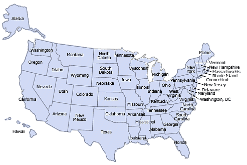
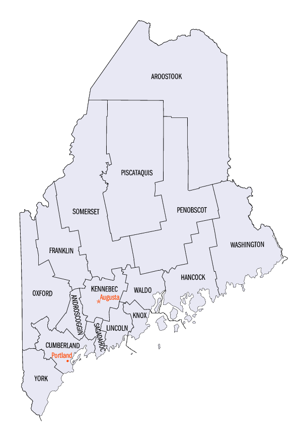
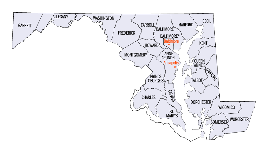
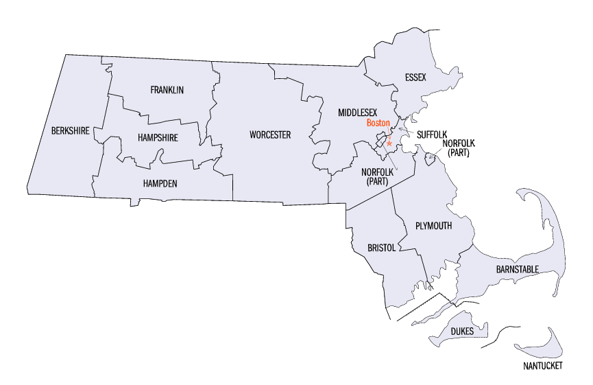
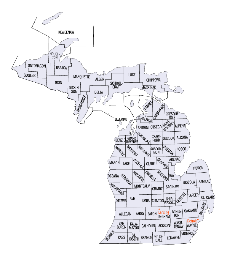
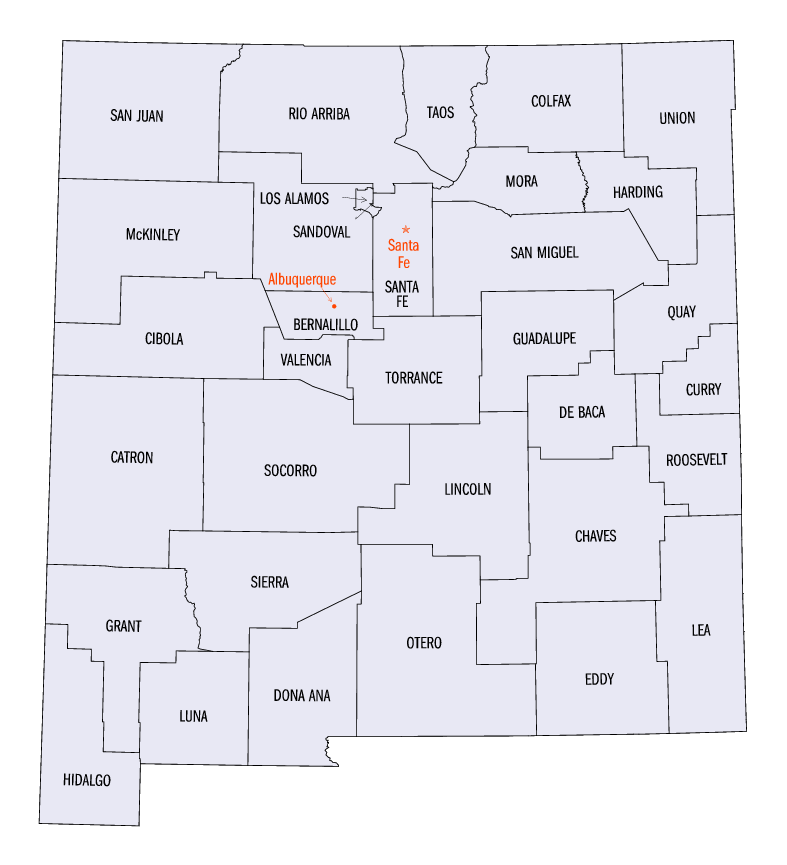
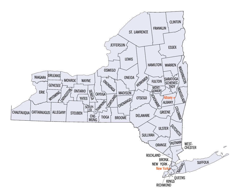
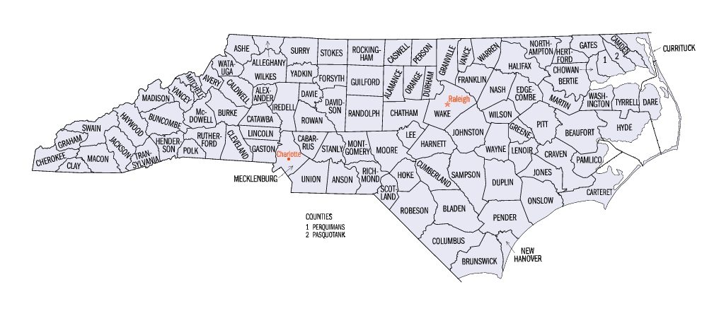
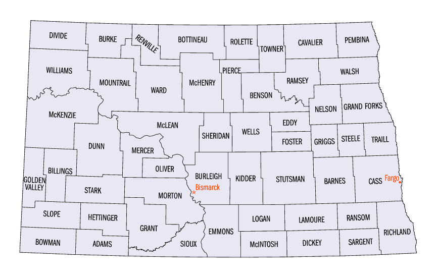
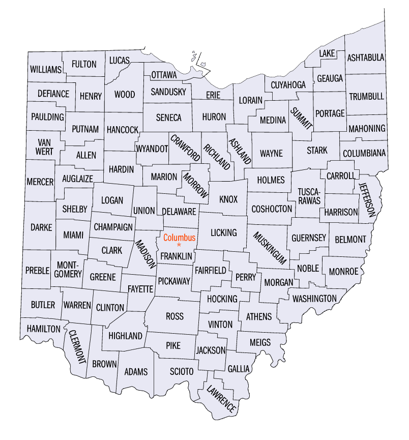
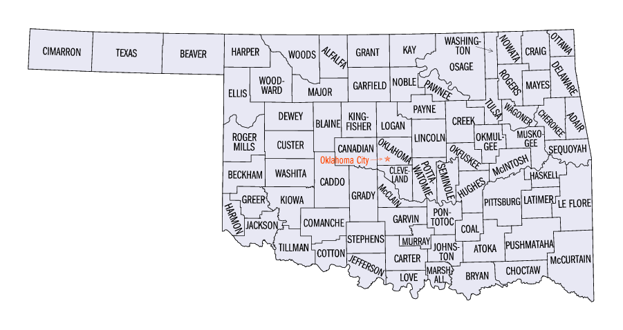
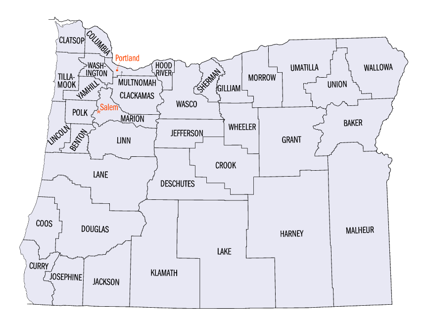
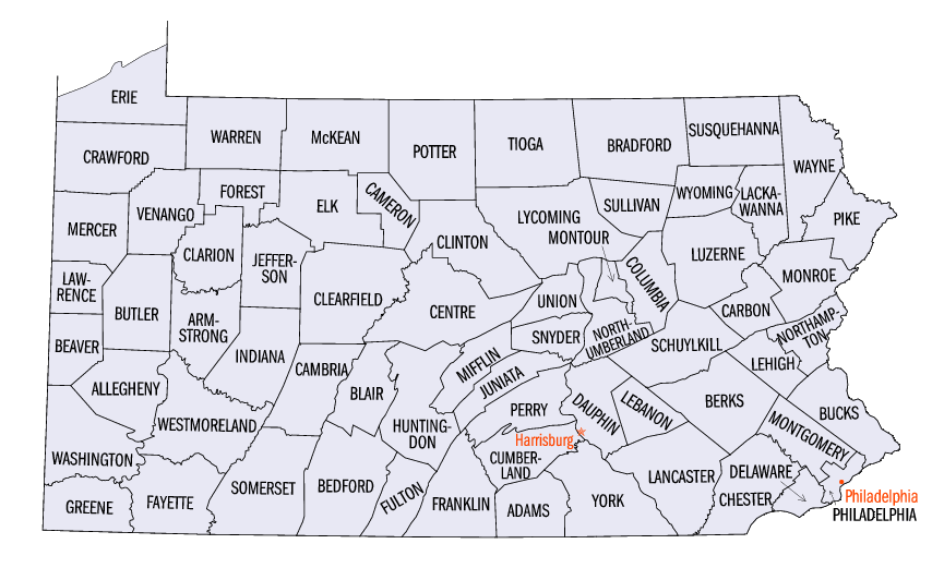
County maps within each state are available by clicking on the state in the US map or by clicking on its name below.
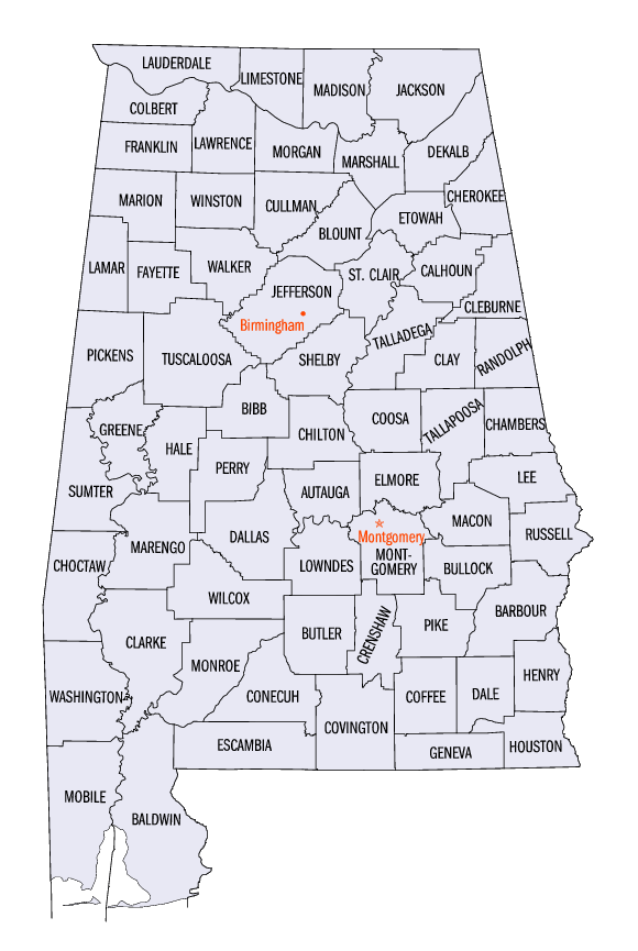
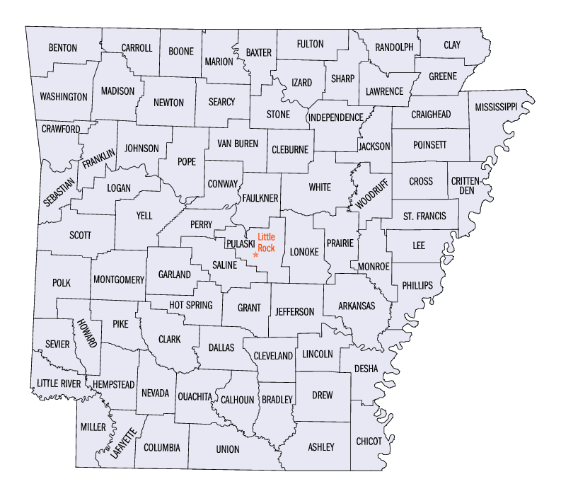
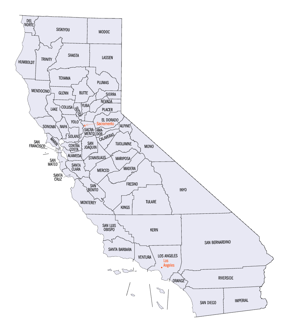
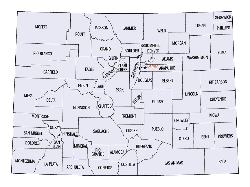
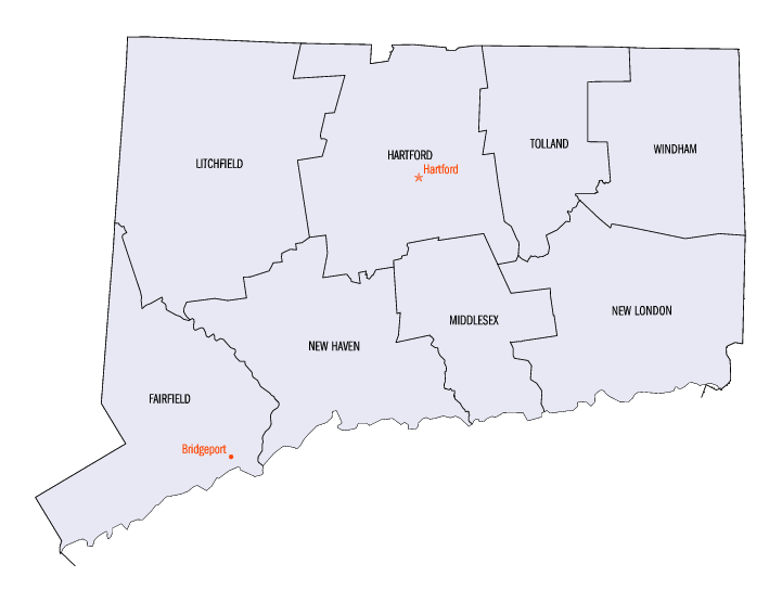
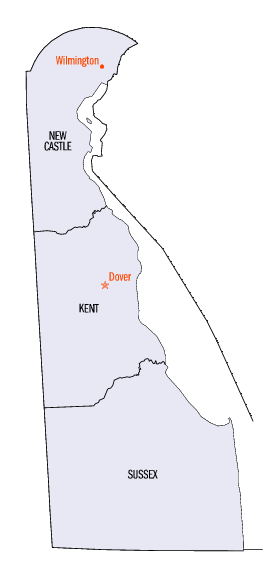
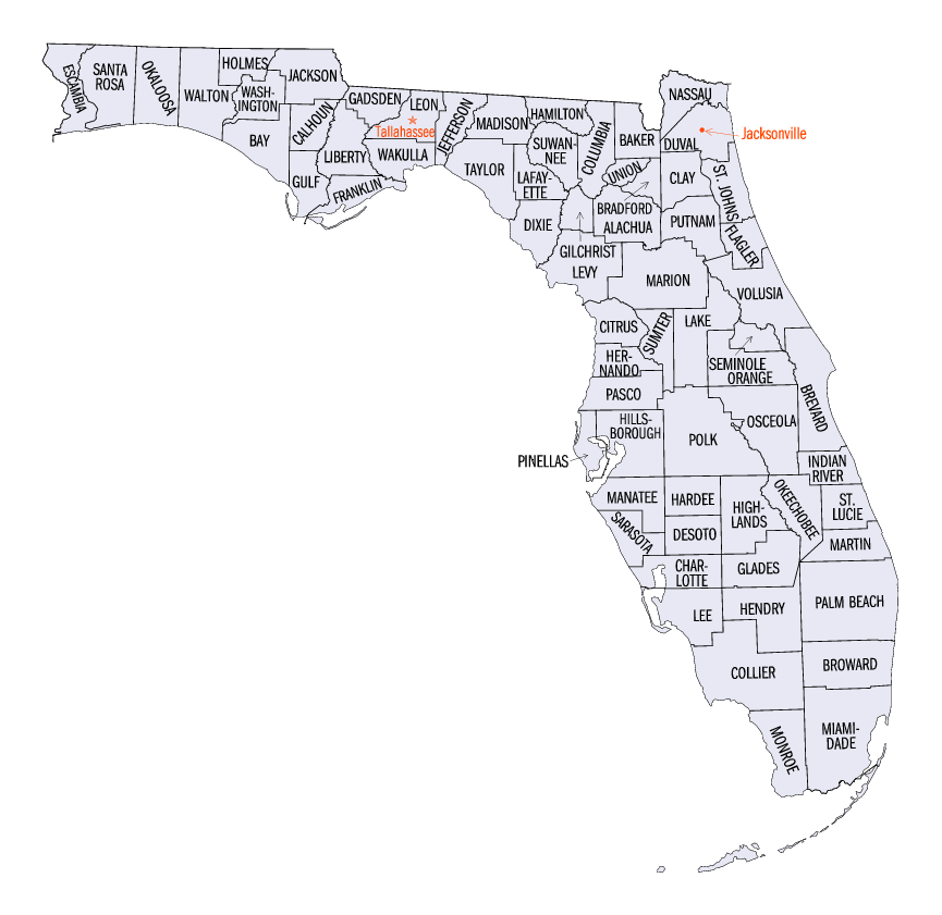
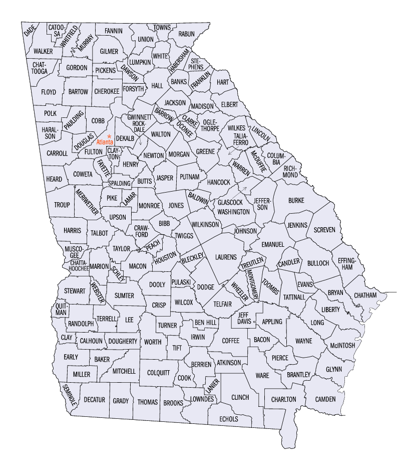
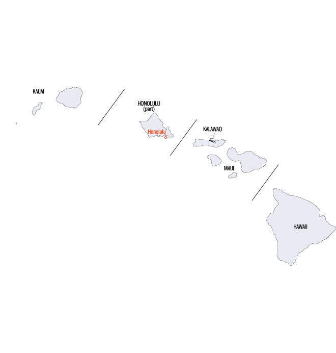
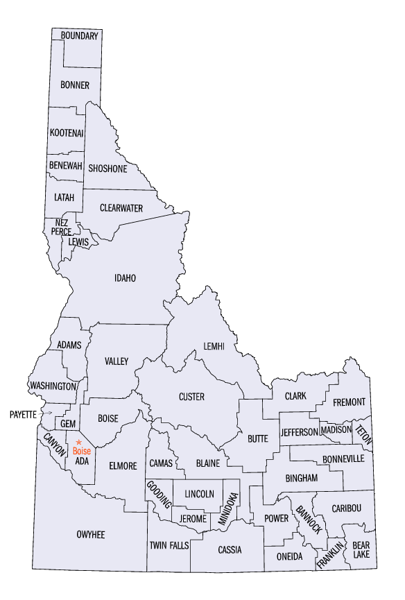
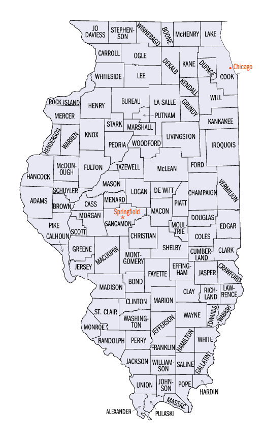
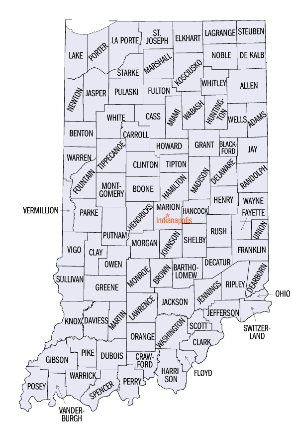
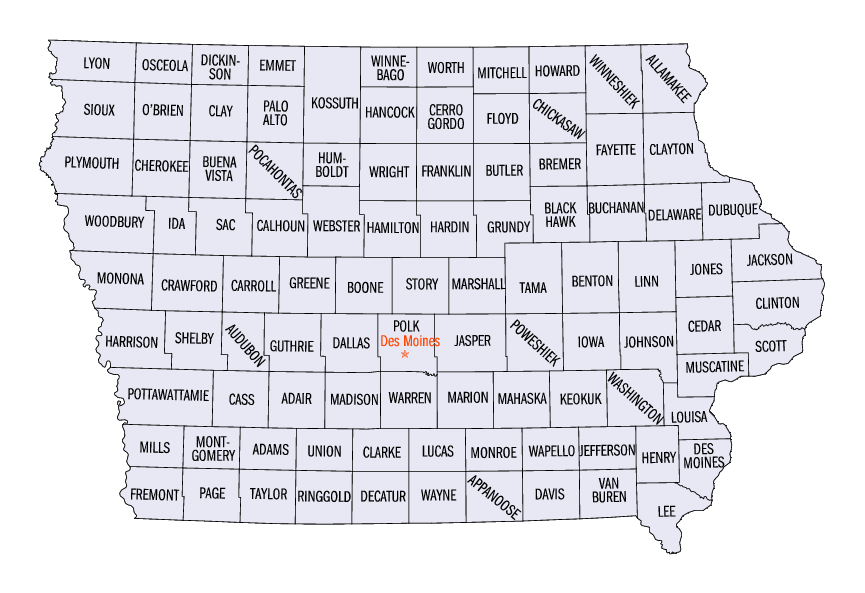
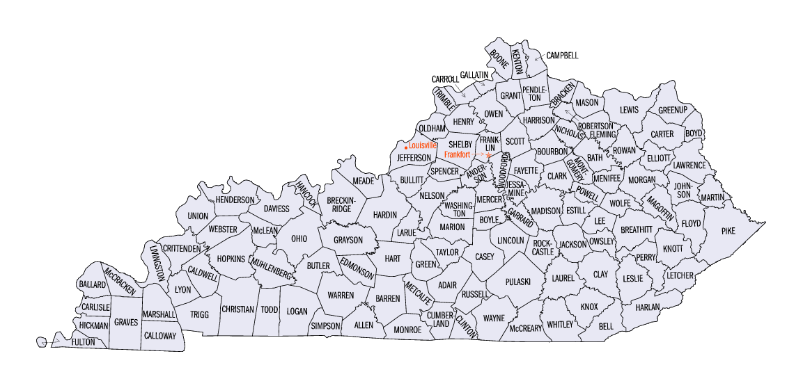
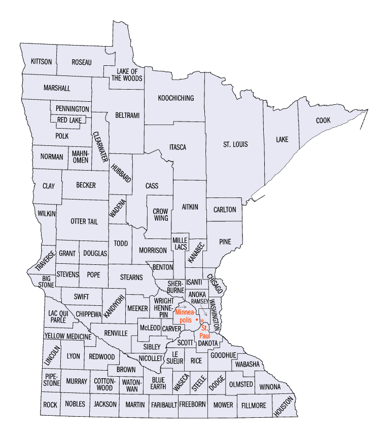
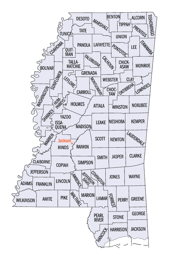
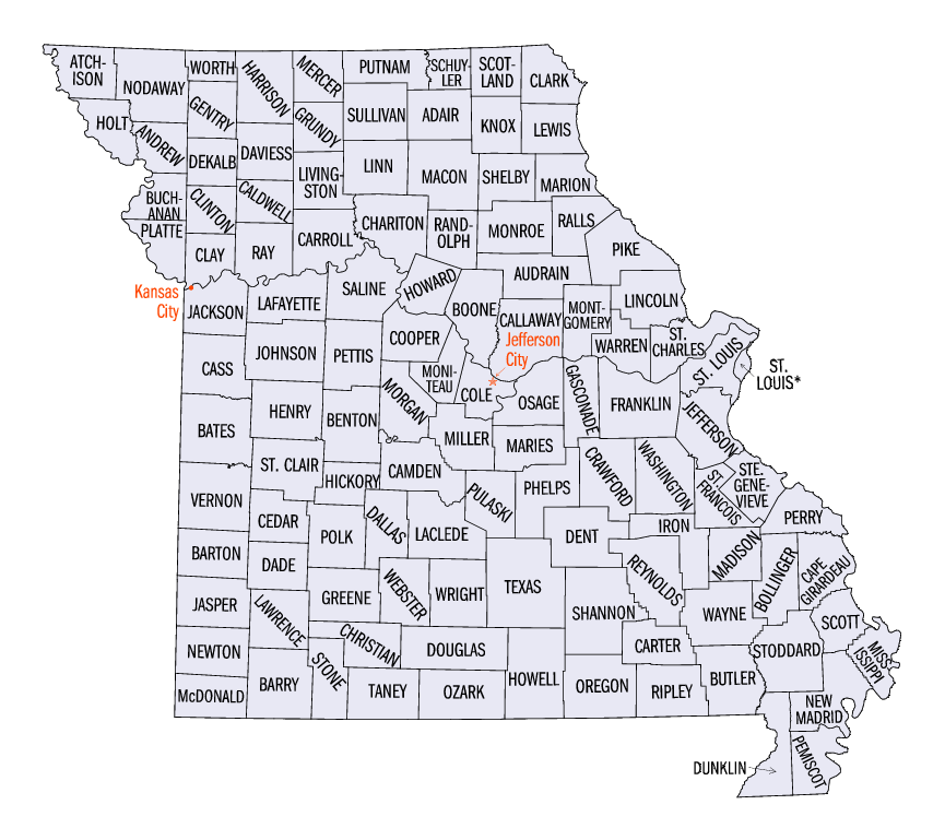
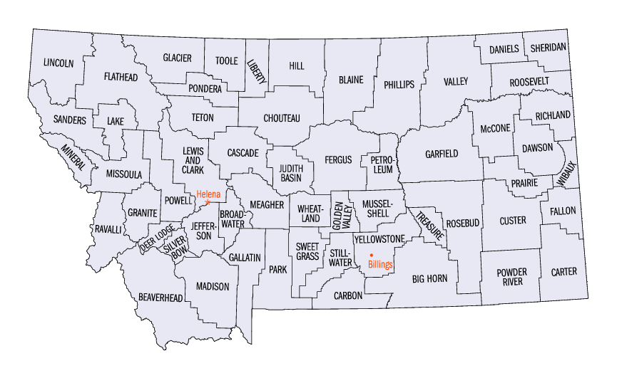
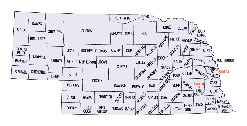
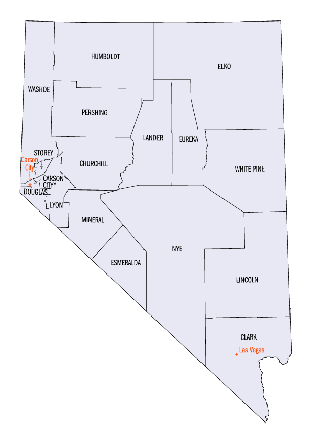
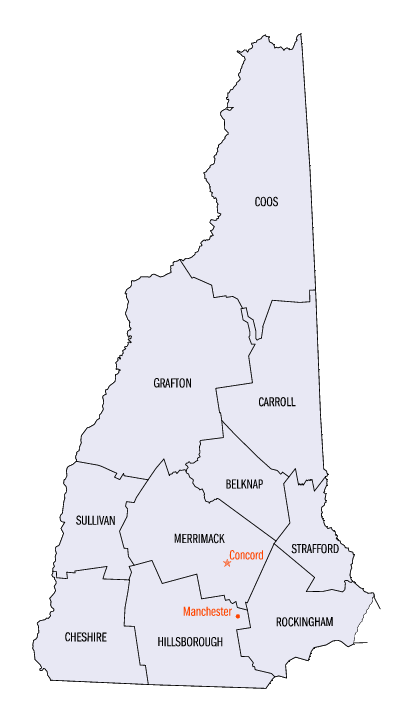
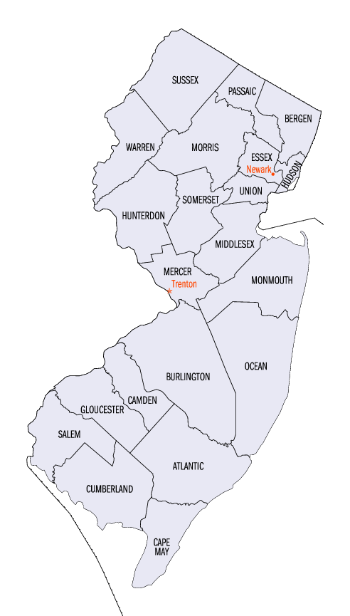
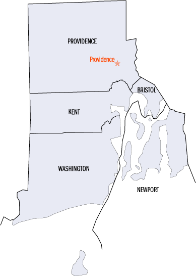
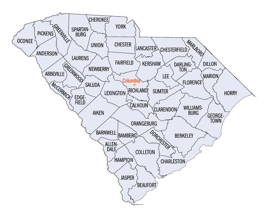
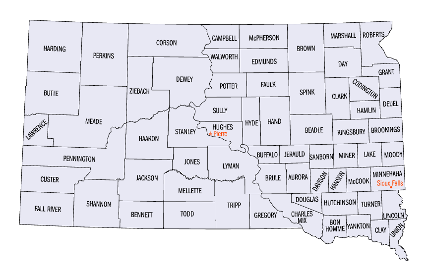
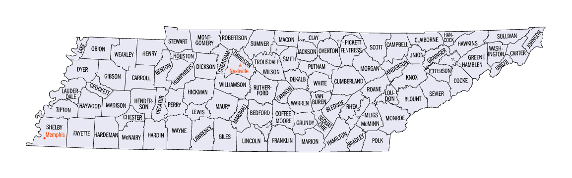
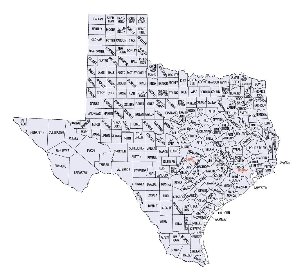
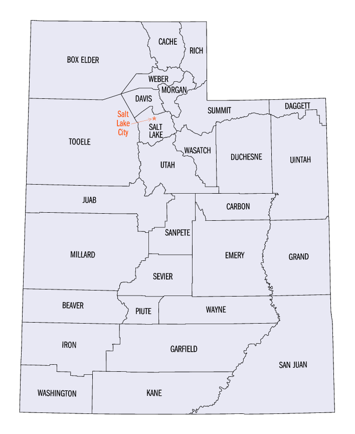
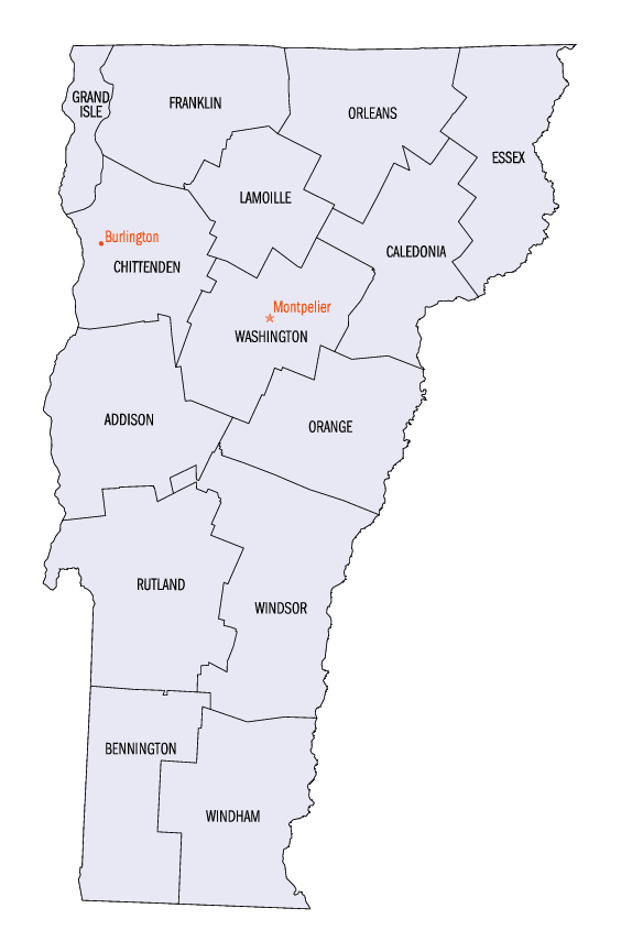
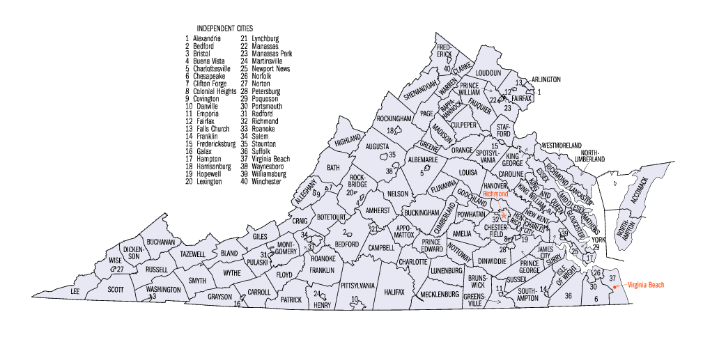
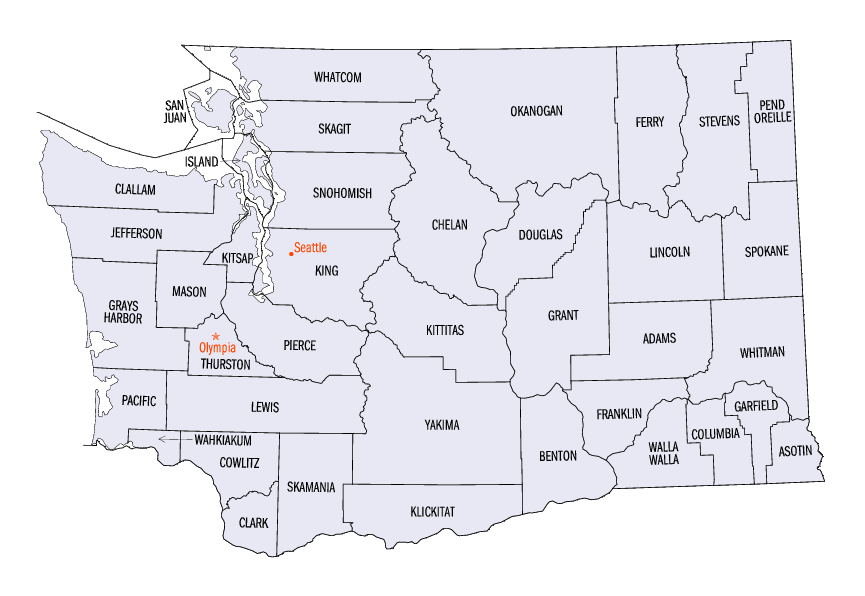
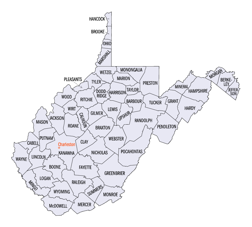
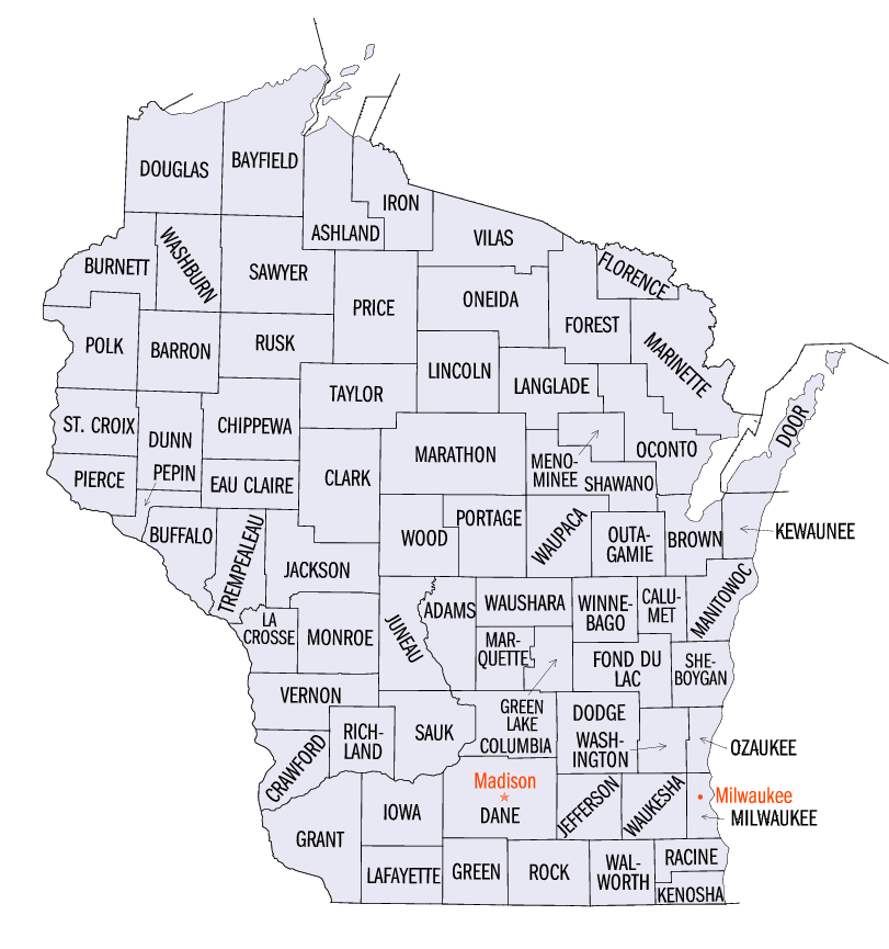
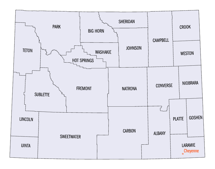
The state capital is indicated by a '*', and the largest city with a dot (if it's not the capital).
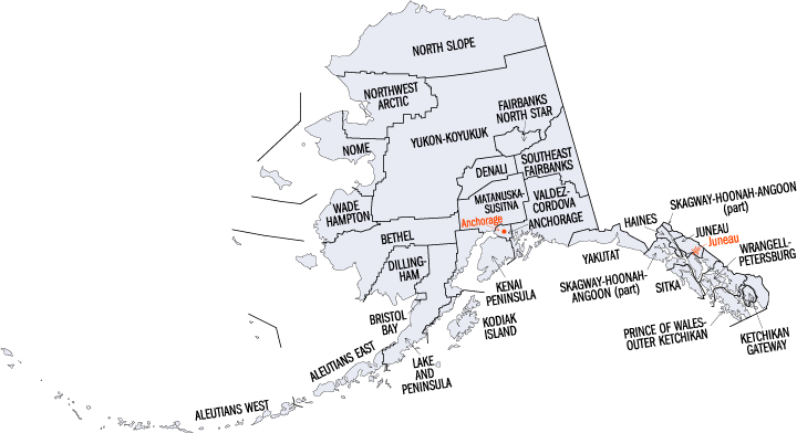
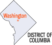
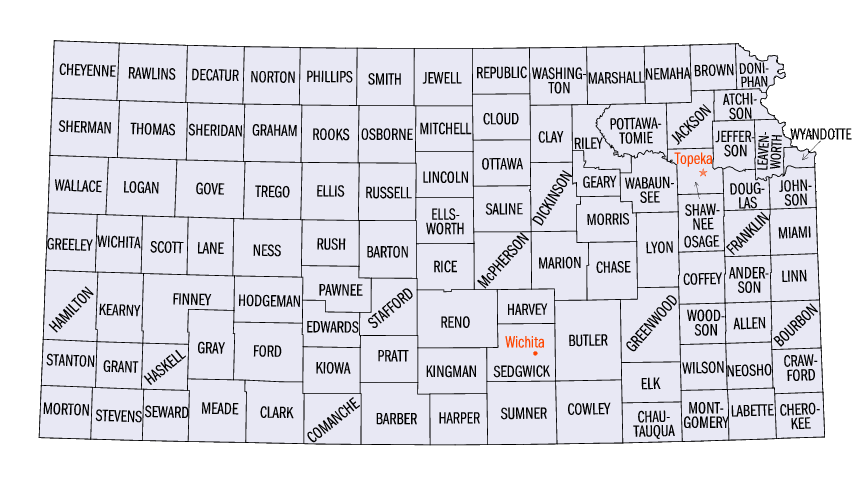
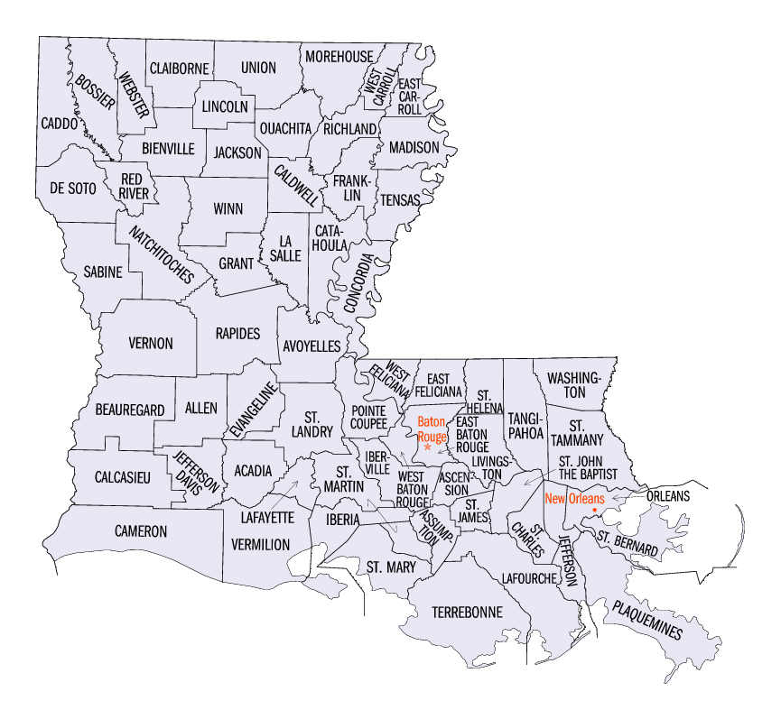
The state capital is indicated by a '*', and the largest city with a dot (if it's not the capital).
|